Drones, lasers and land surveys
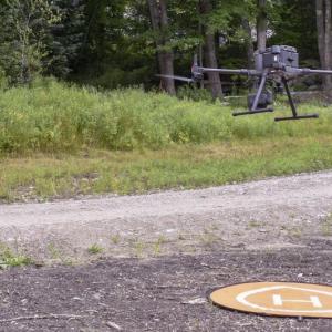
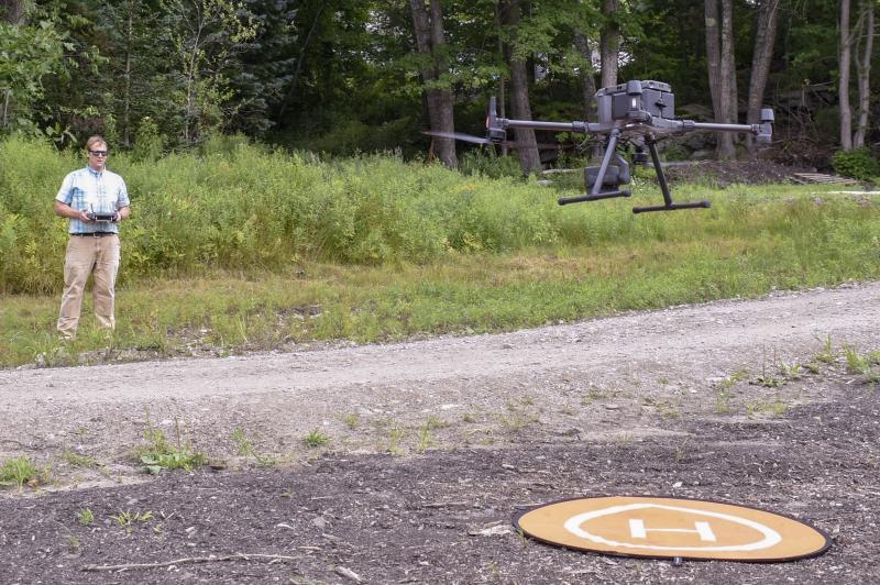 Local surveyor Nicholas Plumer operates a drone with a LiDAR system during a land survey. FRITZ FREUDENBERGER/Boothbay Register
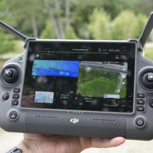
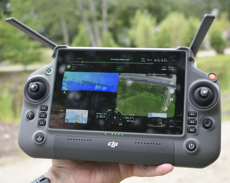 The view from the drone’s controls showing live imagery and LiDAR data. FRITZ FREUDENBERGER/Boothbay Register
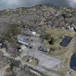
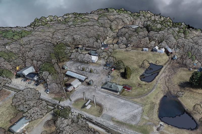 A digital image of Boothbay Railway Village Museum, compiled from photography and LiDAR data collected by a drone. The image represents millions of data points that create the 3D rendering. Image courtesy of Nicholas Plumer
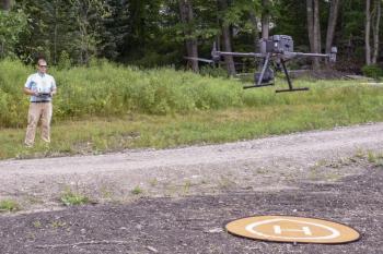 Local surveyor Nicholas Plumer operates a drone with a LiDAR system during a land survey. FRITZ FREUDENBERGER/Boothbay Register
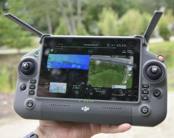 The view from the drone’s controls showing live imagery and LiDAR data. FRITZ FREUDENBERGER/Boothbay Register
 A digital image of Boothbay Railway Village Museum, compiled from photography and LiDAR data collected by a drone. The image represents millions of data points that create the 3D rendering. Image courtesy of Nicholas Plumer
Still an emerging technology, drones have allowed rapid advancements in industries from research to photography. However, recent national legislative action is placing increased scrutiny on foreign drone manufacturers. If passed, it may restrict the availability of Chinese-made drones, impacting users even here in the Midcoast.
The Countering CCP Drones Act has been rattling around both the U.S. House and Senate, including as a potential part of the 2025 National Defense Authorization Act. According to technology media outlet Tom’s Hardware, it is aimed at restricting, or effectively banning, Chinese-made drones from the manufacturer DJI, which controls over 70% of the world’s drone market share.
Proponents of the legislation express concerns about Chinese-manufactured drone risks to security and privacy, and data being made available to a foreign country. A Senate vote may not happen until September, according to DJI, who responded to the concerns and expressed “a longstanding commitment to drone security and safety.”
As the conflict plays out in larger arenas, local surveyor Nicholas Plumer is concerned that restrictions could clip his wings.
Plumer regularly uses drones to survey landscapes across the Midcoast. In large part, he uses Light Detection and Ranging (LiDAR) imagery. LiDAR technology sends out laser light pulses and can make a 3D image of surfaces based on how those beams bounce back. LiDAR can be performed on the ground but it’s most efficient for mapping when instruments are mounted on a plane or drone. During the process, surveyors align the data with GPS ground points to obtain inch-level accuracy around the topography and features of an area.
“It’s a game changer,” Plumer said.
Pointing at a survey of a few hundred acres in Thomaston on his computer, Plumer said the work would take two teams of four surveyors a month of field work to complete. With a drone, it's a few hours’ work of flying and a few days' confirming its accuracy. Plumer said drones also spare surveyors from dangerous situations such as busy roads or Maine’s slippery coastlines. Both approaches require later work on a computer. However, after post processing, features like vegetation can be digitally removed from LiDAR data to model the ground surface, a major advantage.
If the Chinese technology is banned, the DJI tech Plumer already owns won’t be confiscated. However, he may be out of luck if it breaks. American companies offer the technology, but Plumer said the price point is higher for comparable products.
“(A ban) would stop my production ... The first time I had a failure, and I couldn't buy parts. I've got a 3D printer at home. I'll try my damnedest to keep it up in the air, but I'm also not an engineer,” he said. “Some of the American-made LiDAR modules are much better than the one I have, but they're four times more expensive.”
Plumer said the relatively affordable Chinese products help him curb the cost of business by around as much as half, and the technology is a large reason he has not increased prices more through COVID and inflation. In his view, restrictions could have a rippling effect.
“I consider surveying to be one of the ground-level industries in America,” he said. “When the cost of a survey goes up, everything goes up.”
However, for many, drones represent a threat to privacy. Plumer recalled a recent incident this summer where a man approached him during a drone survey. Plumer said the man came on behalf of a neighbor who was steps away from grabbing a gun to shoot the drone out of the air.
Plumer said the situation was diffused after a conversation, but the local incident isn't uncommon. News outlets across the country have reported people shooting down drones. This summer, a Florida man was charged with destroying a Walmart delivery drone. Plumer said he understands the general concern but wants people to feel more at ease.
“I never publish any of the images that went in to make it, and you know you couldn't actually pick out a person on a deck or anything,” he said, and added that moving objects like cars get lost during processing. “I'm extracting no more information from this than we would divulge in a regular survey ...”
Plumer, who is licensed and registered by the Federal Aviation Administration to fly a drone, said surveyors have to give notice to go on a property, but airspace is more of a grey area. Many drones, including Plumer’s, have built-in GPS systems that prohibit them from operating in no-fly zones, such as airports. However, he said flying over homes is more up to judgement and manners. “If someone asked me to not fly over their house, I'd respect them and throw out that data,” he said.
Plumer said the data he collects is limited to local computers and servers. He doesn't have the same concerns as those supporting the legislation, who are worried about data being sent to potentially vulnerable cloud networks or made available to the Chinese government. However, Plumer said he sees the conflict as one of familiarity with the technology. According to him, he is the only independent surveyor in the Midcoast using drone LiDAR data, and one of few in Maine. If the technology becomes more accessible, and not banned, he expects more to follow.
“Because it is such a contested issue, there are a lot of people that are apprehensive to buy into the technology,” he said. “And I think once it becomes a little less contested, I think a lot more people will buy into it and start using it. And then you know everything will become cheaper.”

