More snow on the way

Time to brush off the snow shovels, put back on the plow and tune up those cross country skis. Although there has been a lull in the winter action, the National Weather Service predicts a good old fashioned snow storm for this Wednesday, Feb. 5.
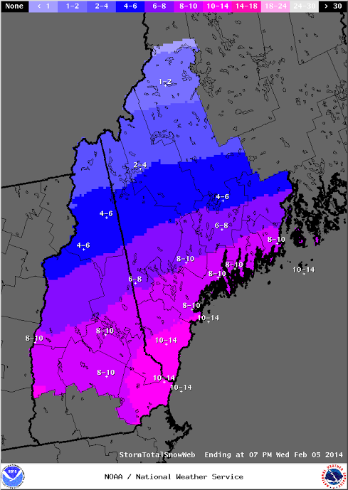
Meteorologist Margaret Curtis said the storm dumping snow on New York City and Boston today will completely miss our region and head out to sea. But another system with its origins on the west coast is expected to dump 6 to 10 inches over the region on Wednesday.
“We expect the storm to develop in the early hours of Wednesday morning and the snow to continue throughout the day,” Curtis said. “With temperatures staying below freezing, we expect the storm to be all snow, but the tips of peninsulas may see some rain.”
Curtis said the current forecast does not predict high winds or blizzard-like conditions. “We expect moderate snowfall throughout the day,” she said.
A high pressure system moving in on the heels of the storm is expected to keep the fluffy white stuff from turning into a sloppy mess. “With daytime highs below freezing on Thursday and Friday, we should see the snow remaining through the weekend,” Curtis said.
Although temperatures are expected to remain cold enough for snow, it will not be an exceptionally cold week. NWS predicts daytime temperatures will hover just below freezing for most of the week. Night time low temperatures in the 20s are predicted for Monday and Tuesday, and then night time temperatures will dip down into the teens Wednesday through Friday.