The 1961 Boothbay Harbor Town Plan
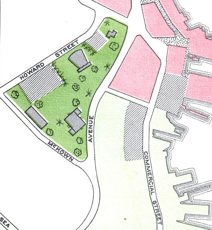
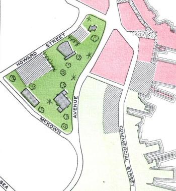
 This 1961 section of the Sewall consultants' plan shows the 3 1/4-acre parcel bounded by McKown Street and Howard Street as they envisioned it if their suggestions were enacted. Municipal buildings were to share space with parking and a park on a lot which ascended steep McKown Hill and was to be enlarged by discontinuing Todd Avenue. It would have necessitated buying many private lots and demolishing buildings.
 This 1961 section of the Sewall consultants' plan shows the 3 1/4-acre parcel bounded by McKown Street and Howard Street as they envisioned it if their suggestions were enacted. Municipal buildings were to share space with parking and a park on a lot which ascended steep McKown Hill and was to be enlarged by discontinuing Todd Avenue. It would have necessitated buying many private lots and demolishing buildings.
Last time, I described the 1961 Boothbay Harbor planning board attempt to get voter approval of a James W. Sewall Company plan to fill in much of the harbor between the east and west sides.
The planners intended to create dry land from Union Street south to the footbridge. That plan didn't succeed, nor did any other of the plan's provisions. However, many years later parts of the plan were carried out. This article doesn't cover every facet of the plan, just some that I thought would be of most interest.
“Useless Swamps”
Many of the other failed 1961 provisions depended on the period's romance with fill, which promised to transform “useless swamps” into town-owned assets or taxable private property with the addition of a lot of dirt. The plan consultants figured there were 188 acres of swamp land in a town of about 3,500 acres. That 5 percent unusable land, small though it was, offended their sensibilities, and they had plans for it.
The first wetland they earmarked for change was Lobster Cove Meadow in a “Rural Residential Area.” Above the Boothbay Center water generally flows north, but below it flows south. On the east side of the peninsula, water drains south into Lobster Cove from the Center, flowing from the area of Elbridge Giles's gravel pits near the dump to the old Boothbay town wells area and across Route 96 on its way to the sea.
The consultants suggested either damming that low-lying watery meadow to create a lake for subdivisions or draining it all for subdivisions. Damming would have necessitated a bridge to East Boothbay, and draining would have been a never-ending task. That water has to go somewhere.
Water in the middle of the peninsula drains south to Mill Cove. In the early 1900s, the Harbor annually appropriated money for “the meadow drain” — ditch digging southwest to Mill Cove to keep the main road, present Route 27 through the Meadow, above water. The 1961 consultants suggested filling the Meadow all the way to Mill Cove. That wetland occupies a section they designated the “Urban Fringe.” The Meadow includes Penny Lake between Hannaford and Mill Cove and the built-up strip between the Harbor proper and the high school.
A harbor dump and civic center
Now covered with businesses, the Meadow was formerly fairly empty of buildings, featuring cattails instead — you can still find a few stands here and there. That very fertile stretch was once the Harbor's premier farmland. After filling it, the planners envisioned a town dump on the site now occupied by Flagship Motel.
Additionally, they planned a road through future-dry Penny Lake, diverting those going west to West Harbor and Southport away from the business district. And the planners called for an elementary school on fill just south of the high school, a plan that did come about in 1977.
The consultants mentioned other swampy areas on the west side of the Harbor ripe for reclamation, but didn't suggest specific plans. Perhaps they assumed they'd be filled for future house lots.
The consultants intended a sewage plant where the waterfront parking lot is, and hoped to discontinue the town office, located down McKown Street, in favor of one further away from the business district, north on Oak Street or Townsend Avenue. They resurrected, whether they knew it or not, parts of Dr. James Todd's 1930s plan to create a civic center and park in the vicinity of Howard Street and Todd Avenue, now the town office and town parking lot across from it.
The 1961 planners included some parking, municipal buildings, and patches of green, while eliminating Todd Avenue. All the private lots, businesses, and homes within the area bounded by McKown, Oak, and Howard streets were to be bought for the town's civic complex in “The Central Area.”
Zoning still in the future
The planners proposed zoning regulations, explaining that the 1957 attempt to introduce zoning failed due to “lack of understanding by the voters and inadequate information provided to them.” Perhaps so, but maybe the idea of willingly giving up control of your own property for the good of the “entire citizenry” was then novel and objectionable.
The old Scotch-Irish independence bred a naturally stubborn, self-reliant streak, “Nobody's going to tell me what to do,” sums it up very well. It's no wonder the whole plan was rejected.
Such an ambitious plan to reimagine and manage the town in mid-century was bound to fail, and it may be that such grand plans are usually too unwieldy and disruptive to gain approval.
As I said last time, “People don't warm up to being managed by consultants.”
But it's interesting to go back to another time through this pre-EPA, pre-DEP plan, written when environmental concerns and intricate zoning were still down the road.
Event Date
Address
United States


